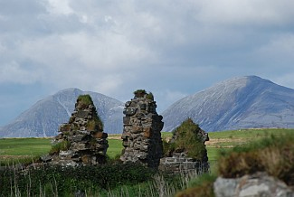
Islay Facts and Figures
Islay, (Latitude: 55 45N. Longitude: 06 16W), the most southerly island of the Inner Hebrides of Scotland, lies at the entrance to the Firth of Lorn to the west side of the Kintyre peninsula and roughly 35 miles north of Northern Ireland. With its neighbouring islands of Colonsay and Jura and some smaller isles, it forms the Islay group; a distinctive set of islands which share cultural and historical as well as geographic links. The island measures some 40km in width by 25km in length, but with a heavily indented coastline and the deep bays of Loch Gruinart and Loch Indaal, the land area amounts in total to about 600km2. These bays, arranged back to back, almost divide the island in two. Much of Islay is low-lying and fertile although it also has high moorland and hills, the highest of which is Beinn Bheigeir at 491m. The variety evident in the Islay landscape is due to its underlying geological structure. Hard quartzites form the rugged uplands while the lower lying, more fertile land is underlain by limestone and mica schists. There are extensive raised beach deposits within the bays and substantial areas of blown sand both on the coast edge and extending into the hinterland. There are numerous fresh water lochs in the hinterland, and abundant streams, some of which form falls on the higher parts of the coast edge.

Ballivicar Farm near Port Ellen
This varied geology supports a range of natural environments, ranging from heather moorland, peat bogs, wetlands and salt marsh to deciduous and coniferous woodlands, rich grassland and scrub forest. Islay has a relatively mild climate, being warmed by the waters of the gulf stream and largely sheltered from the open waters of the Atlantic Ocean. While snow and frost occur relatively rarely, gale force winds are not uncommon. Agriculture forms the largest single economic activity on Islay, the whisky industry and tourism are other important sources of income. Much of the farmed land is used as grazing for cattle and sheep although some arable cultivation is also carried out. Large tracts of the higher moorland and hill land is incorporated into deer shooting estates. Several of the peat bogs are regularly cut, providing fuel both for the eight distilleries and for private use. There are coniferous tree plantations, concentrated mainly to the south east and eastern parts of the island. The area around the head of Loch Gruinart is a designated nature reserve managed by RSPB.
The local authority of Islay is Argyll and Bute. At the last census of 2001 Islay had 3457 inhabitants, almost thousand of them live in the island's capital of Bowmore. Other major villages are Port Ellen, Port Charlotte and Portnahaven. Islay is also known as the place where the world's first commercial wave-powered electrical generation station was built in 2000 near Portnahaven. One of Islay's best known persons in the world is Lord George Robertson, former Nato Secretary General, who was born in Port Ellen.

Farmland and Hills near Ballygrant
|